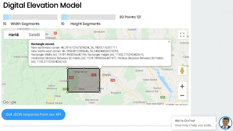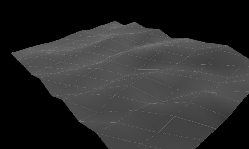
Digital Elevation Model API and APP - Terrainizer (a solution to digital terrain model) is a cross browsers REST API supporting now a maximum of 2601 3D Points per request including all the selected rectangled surface as an array of equally distanced 3D Points as you may see in the rectangled figure on our website https:www.de-vis-software.ro/digital-elevation-model.aspx . The digital elevation model download or digital terrain model (mesh 3D model) is based on a selecting rectangle of a slice on Earth (it may be also on oceans, seas). As data input you need to specify the North East Corner Latitude and Longitude and the South West Corner Latitude and Longitude (as upper right corner and the lower left corner of the selecting rectangle) and also the number of dividing segments on the width of the rectangle (npwidth) and the number of dividing segments on the height of the rectangle (npheight). The number of 3D Points is calculated as (npwidth+1)*(npheight+1). As more 3D points are, as smooth is the resulted mesh 3d model. Pret 449 lei